
Description
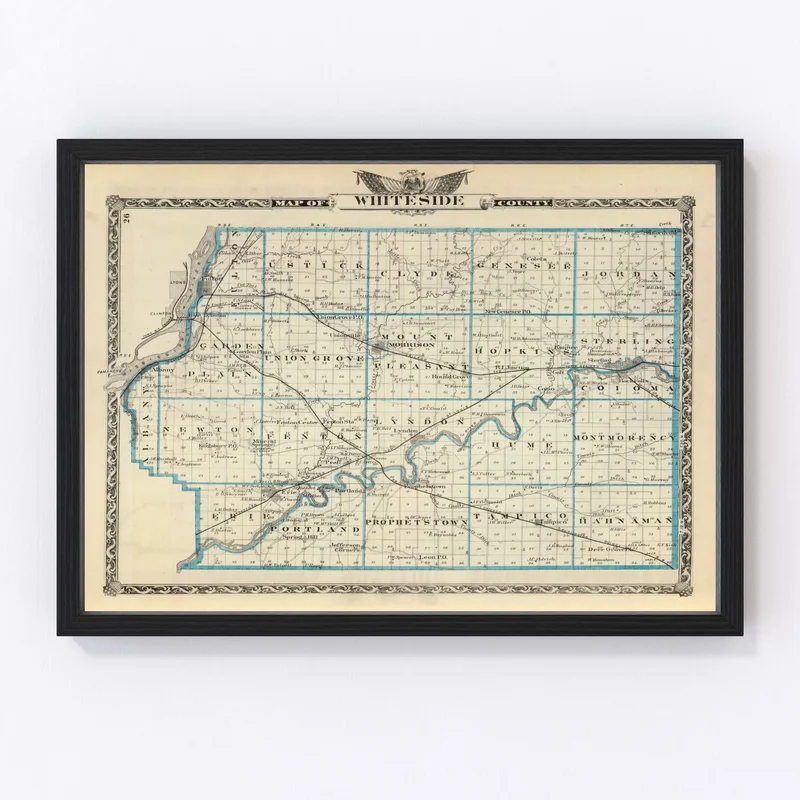
Discover a piece of the past with our expertly restored 1876 map of Whiteside County, Illinois. This vintage gem brings local history to life and makes a thoughtful gift for history buffs or anyone who cherishes their roots in this charming region. Notable towns like Sterling, Rock Falls, and Morrison are featured prominently, offering a unique glimpse into the area as it was nearly 150 years ago.
Crafted with an eye for detail, our prints are designed to complement any room’s decor. Whether you’re planning to hang it in your home or office, its traditional look adds a touch of class wherever it’s placed. The map is constructed by hand; framed prints use solid wood that’s carefully stained for durability and style, while canvas options boast polycotton material on sturdy wood stretcher bars. If you prefer unframed versions, you’ll appreciate the high-quality matte paper that enhances every line and detail.
This beautifully crafted piece isn’t just art; it’s an engaging conversation starter that celebrates local heritage right out of the box.
Reviews
There are no reviews yet.