
Description
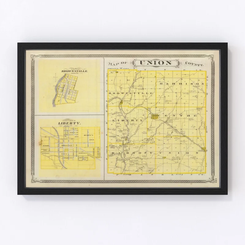
Discover a piece of Union County, Indiana’s past with this beautifully restored 1876 map print. Digitally refined by Ted’s Vintage Art, it offers a glimpse into the historical landscape of the area. Notable towns like Liberty and College Corner come to life on this charming piece that celebrates local history. Its traditional design makes it an ideal addition to your home or office.
The quality here is top-notch, crafted by hand for durability and aesthetic appeal. Whether you choose a framed version with solid wood stained frames or prefer the polycotton canvas stretched over wooden bars, you’re getting something special. Unframed prints showcase their vivid details on high-quality matte paper.
This map isn’t just decor; it’s a conversation starter and perfect gift for anyone who values local heritage. No assembly required—all prints are ready to hang right out of the box.
Reviews
There are no reviews yet.