
Description
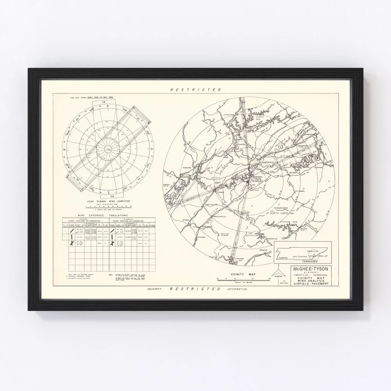
Explore a slice of Knoxville’s history with this beautifully restored 1952 vintage map, showcasing Knox County in the heart of Tennessee. Whether you’re a local history buff or simply love classic decor, this map makes for the perfect addition to your space. It’s more than just wall art; it’s a piece that sparks conversations and creates connections with its rich historical context.
Handcrafted with attention to detail, each print is made using top-quality materials. Choose from ready-to-hang options featuring solid wood frames stained for an elegant touch, or opt for our durable polycotton canvas stretched on solid wood bars. If you prefer something more flexible, our unframed versions are printed on premium matte paper that promises durability and longevity.
This unique piece is also a fantastic gift idea for those who appreciate Knoxville’s charm and heritage. Ideal for home or office spaces, it brings an element of timeless style that’s sure to impress anyone who looks closely at its intricate details.

Reviews
There are no reviews yet.