
Description
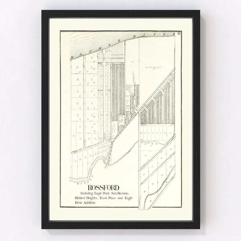
Discover a piece of history with our meticulously restored 1912 vintage map of Rossford, nestled in Wood County, Ohio. Whether you’re a history buff or simply love the charm of old maps, this print is a delightful addition to any space. Designed to spark conversations, it offers a glimpse into the past and showcases Rossford’s layout over a century ago.
This beautifully crafted piece comes ready to hang straight out of the box. If you choose the framed option, you’ll appreciate its solid wood construction finished with an elegant stain that complements any decor style. Our canvas prints are lovingly made by hand on polycotton canvas stretched over sturdy wooden bars for durability and quality.
For those who prefer something more understated, consider our unframed prints on high-quality matte paper. They make thoughtful gifts for friends or family who have an interest in local history or enjoy unique home accents.
Add a touch of classic sophistication to your home or office while celebrating Rossford’s rich heritage with this distinctive map print.
Reviews
There are no reviews yet.