
Description
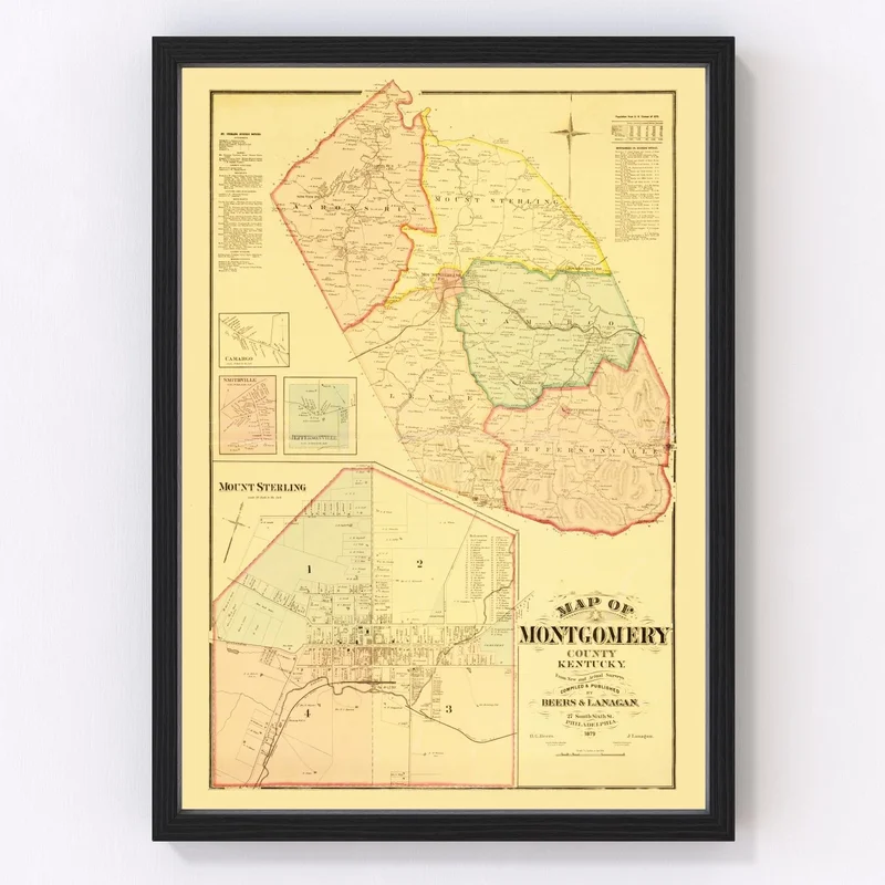
Step back in time with our beautifully restored 1879 map of Montgomery County, Kentucky. Perfect for history buffs, collectors, or anyone who holds a special place in their heart for the Bluegrass State, this piece celebrates the rich past of areas like Mount Sterling and Jeffersonville. Our high-quality print arrives ready to hang, so you can instantly enjoy this classic addition to your decor.
Each piece is constructed by hand using premium materials to ensure lasting quality. Choose between framed options crafted from solid wood or unframed prints on superior matte paper. If you opt for the canvas version, rest assured it’s made by hand and stretched over durable wood bars for an elegant look.
This vintage map serves as a thoughtful gift that not only adds charm to any room but also sparks conversations about local history and heritage. Whether displayed at home or in the office, it’s sure to be admired by guests and family alike.
Reviews
There are no reviews yet.