
Description
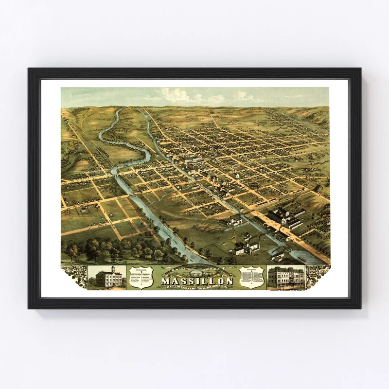
This beautiful, digitally restored vintage map from 1870 showcases Massillon in Stark County, Ohio. It’s a wonderful gift for history buffs or anyone with ties to the area. Presented with remarkable quality, this print is more than a decorative piece—it’s a fascinating glimpse into local history that can spark conversations in your home or office.
Constructed by hand, our framed prints feature solid wood that is carefully stained to complement any decor style, while canvas prints use durable polycotton material stretched over sturdy wooden bars. If you prefer an unframed option, we offer high-quality matte paper to bring out the rich details of this historic map.
Ready to hang right out of the box, it’s easy to add timeless charm and character to your space with this exquisite print. Whether you’re passionate about Ohio’s history or simply appreciate classic design elements in home decor, this vintage map will make an interesting and sophisticated addition wherever it finds its place.
Reviews
There are no reviews yet.