
Description
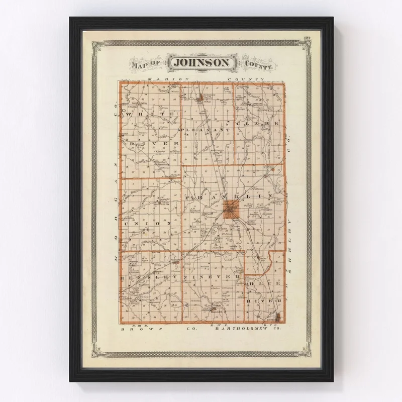
Are you a lover of local history and timeless decor? Our meticulously restored 1876 vintage map of Johnson County, Indiana, might be just what you’re looking for. This handsome piece showcases the rich past of notable towns like Franklin and Greenwood. Whether adorning your living room or adding a touch of class to your office, it’s bound to spark interesting conversations.
Our prints come ready to hang right out of the box, making it an effortless addition to any space. Choose from elegantly stained solid wood frames or our handcrafted canvas prints made with polycotton on sturdy stretcher bars. Unframed options printed on high-quality matte paper are also available for those who prefer flexibility in presentation.
This map makes a thoughtful gift for anyone fascinated by local history or vintage cartography. It’s more than just artwork; it’s a glimpse into the heritage that highlights Johnson County’s legacy in Indiana, carefully preserved and beautifully presented through modern restoration techniques.
Reviews
There are no reviews yet.