
Description
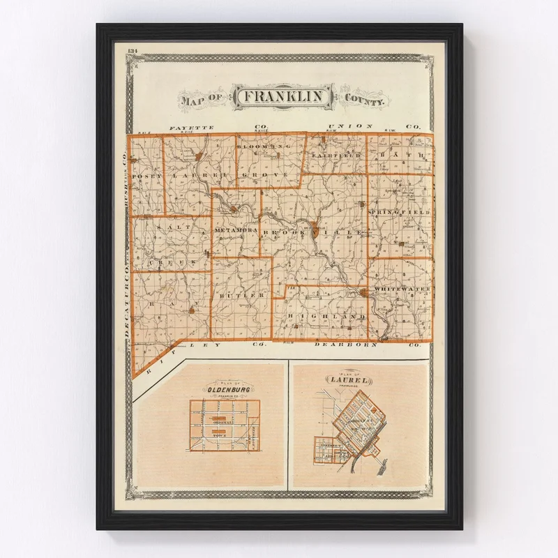
Step back in time with our expertly restored vintage map of Franklin County, Indiana. Originally crafted in 1876, this historical treasure is a gorgeous nod to the past, highlighting towns such as Brookville and Metamora. Whether you’re gifting it to a history buff or adorning your own walls, it’s sure to spark engaging conversations about local stories and heritage.
The meticulous craftsmanship shines through every detail. Our ready-to-hang prints are framed with solid wood that’s beautifully stained to complement any decor. If you prefer a canvas finish, know that each piece is carefully handmade using polycotton canvas stretched over solid wood bars for lasting durability. And for those who want more flexibility in their display choices, unframed maps come printed on high-quality matte paper.
This map doesn’t just serve as beautiful decor; it’s also an invitation to explore the rich history residing within the geography of the past United States landscape — perfect for home or office settings alike.
Reviews
There are no reviews yet.