
Description
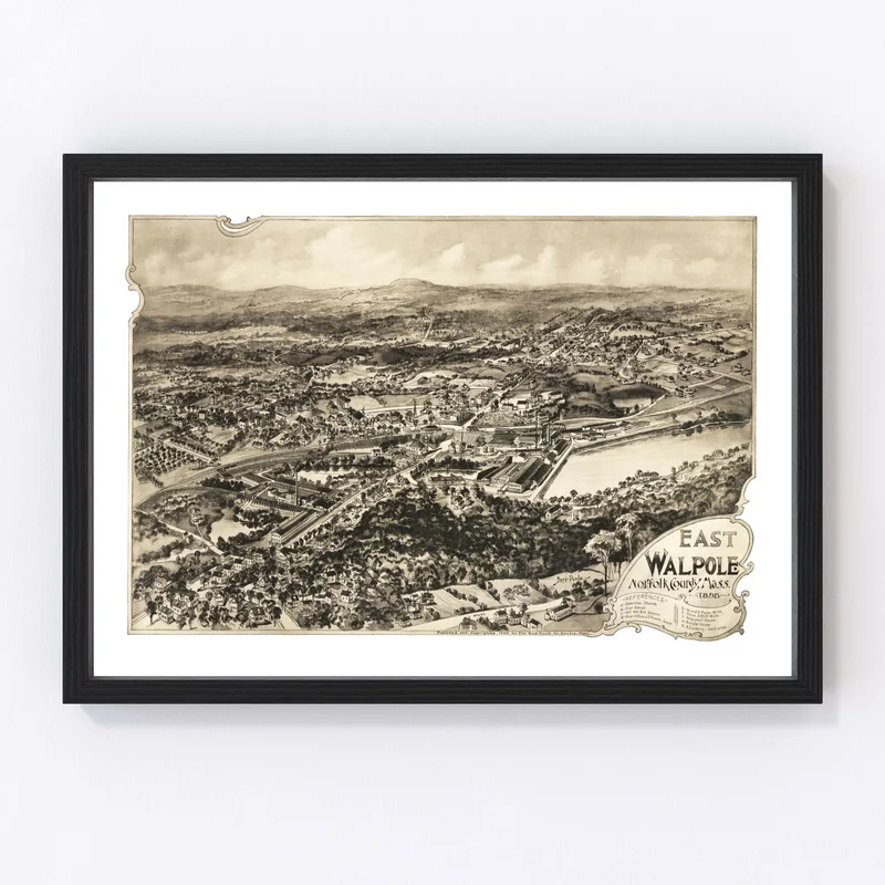
Discover the charm of yesteryear with our meticulously restored 1898 map of East Walpole, nestled in Norfolk County, Massachusetts. It’s a perfect blend of history and sophistication that makes an ideal gift for history enthusiasts or anyone who enjoys celebrating local heritage.
This piece isn’t just another map; it’s a conversation starter that’s ready to hang as soon as you receive it. Whether you choose a framed edition, crafted by hand from solid wood and stained to perfection, or a canvas print stretched over sturdy wooden bars, you’ll be impressed by its quality. If you prefer unframed options, our high-quality matte paper ensures your print looks stunning on any wall.
Perfect for home or office use, this vintage map adds a traditional touch without being overwhelming. It’s not just decor—it’s part of your story and East Walpole’s fascinating past. Ready to bring a piece of 1898 into today? Explore the timeless appeal with Ted’s Vintage Art maps.
Reviews
There are no reviews yet.