
Description
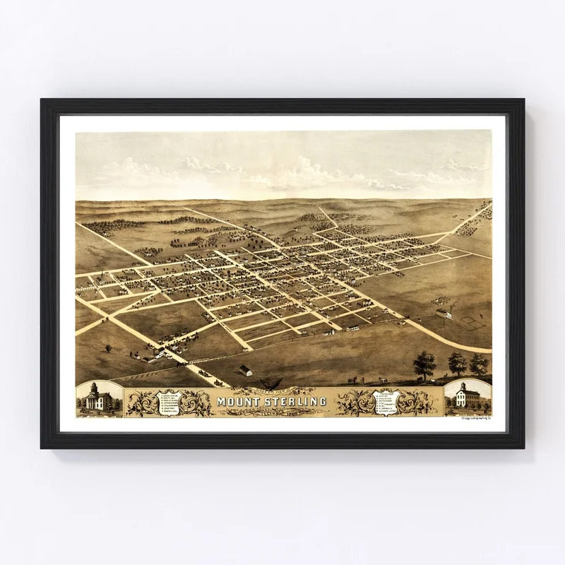
Discover a piece of history with our beautifully restored 1869 vintage map of Mount Sterling, located in Brown County, Illinois. Perfect for history enthusiasts or anyone with a connection to this charming region, this map serves as more than just decor—it’s a gateway to the past.
Our prints are crafted meticulously by hand and showcase exceptional quality materials. Whether you choose an elegantly stained solid wood frame or opt for a canvas print stretched over durable wooden bars, each piece is designed to be ready to hang as soon as it arrives. For those who prefer flexibility in their wall art choices, our unframed prints are made using high-quality matte paper that offers clarity and detail.
This map makes an outstanding addition to any home or office space—a timeless conversation starter that pays homage to Mount Sterling’s rich heritage. Celebrate local history with this perfect gift choice or simply enhance your surroundings with something wonderfully traditional and classy.

Reviews
There are no reviews yet.