
Description
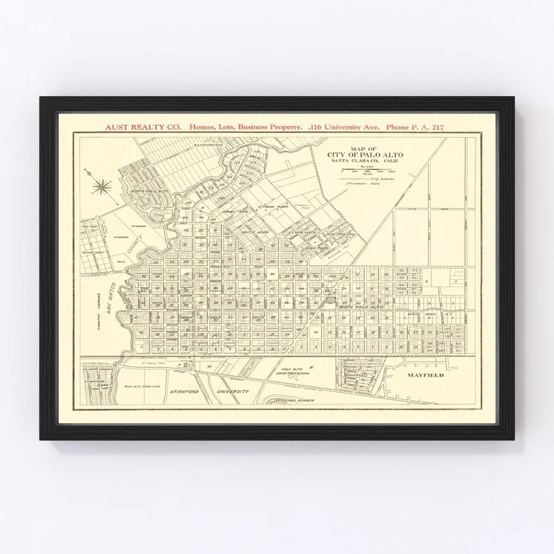
Step back in time with our stunningly restored 1924 vintage map of Palo Alto, nestled in the heart of Santa Clara County, California. This map captures a unique slice of history that any local history enthusiast would love to explore. Whether displayed in your home or office, it adds a touch of traditional charm and serves as an intriguing conversation starter.
Each print is crafted with meticulous attention to detail, ready for you to hang right out of the box. Opt for a frame? Ours are not only made by hand but also constructed using solid wood and given a rich stain finish for an elegant look. Prefer something different? Our canvas prints are made on polycotton canvas stretched over sturdy wood bars—again all crafted by hand—to ensure quality and longevity. If you go unframed, you’ll be impressed by the high-quality matte paper used.
This piece isn’t just decor; it’s a celebration of Palo Alto’s storied past—a perfect gift for anyone cherishing the tapestry woven into this fascinating locale.
Reviews
There are no reviews yet.