
Description
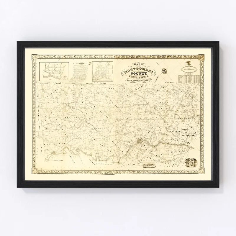
This beautifully restored vintage map of Montgomery County, Pennsylvania from 1849 is a charming piece that’s both informative and decorative. Perfect for history buffs or anyone with an appreciation for classic cartography, this map showcases the rich heritage of local areas like Norristown, Pottstown, and Lansdale.
Expertly crafted by hand using high-quality materials, our prints ensure long-lasting quality. The framed versions feature solid wood stained frames that arrive ready to hang right out of the box. If you prefer something more versatile, our unframed prints come on premium matte paper suitable for any setting. For those who appreciate texture and depth in their decor, the canvas option is lovingly handmade using polycotton stretched over durable wood bars.
Whether you’re enhancing your home or office space or searching for that unique gift idea, this county map serves as a captivating conversation starter that pays tribute to local history. Enjoy a glimpse into Montgomery County’s past while complementing your current style effortlessly.

Reviews
There are no reviews yet.